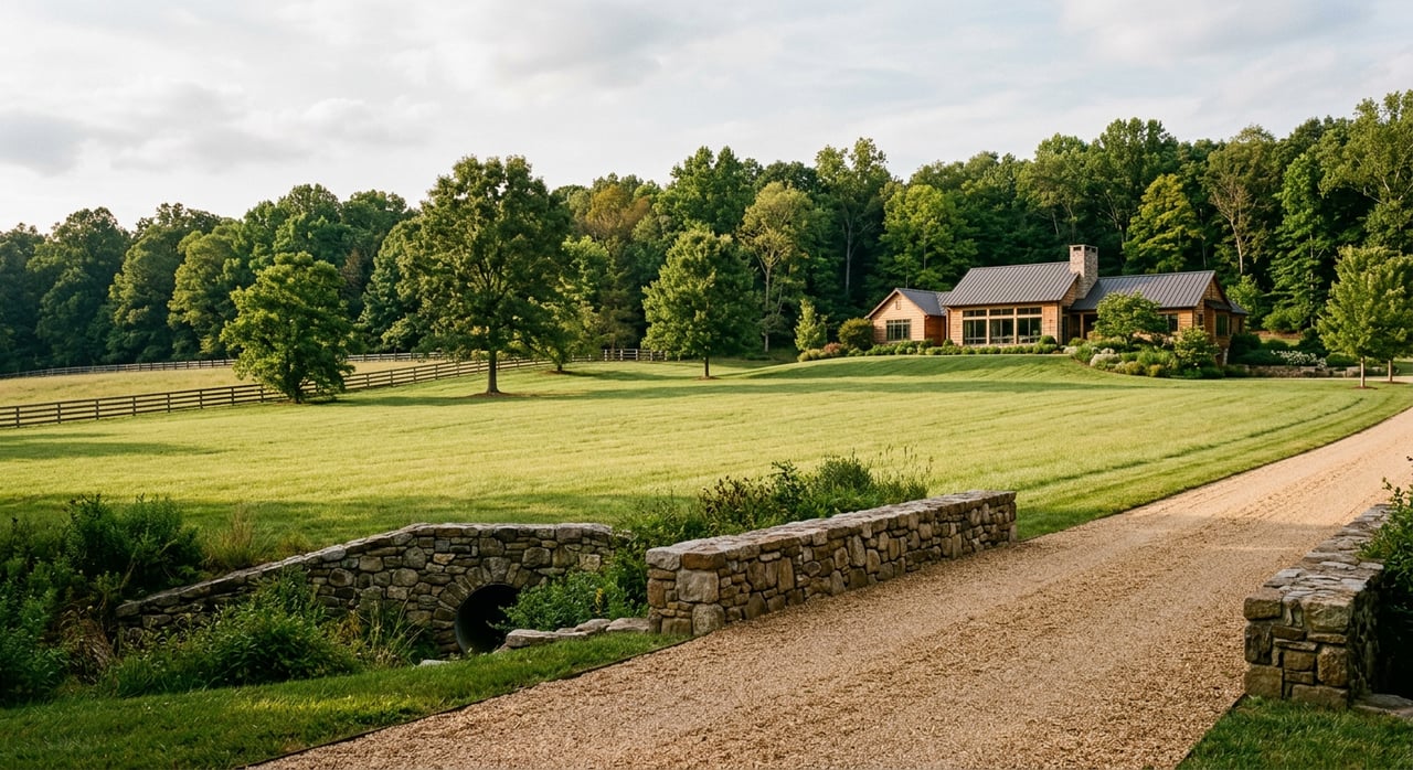
You can picture the views, the privacy, and the space, but buying land in Albemarle County takes more than a good gut feeling. Parcels here can sit in protected Rural Areas, carry stream buffers, or depend on private wells and septic systems. If you want a smooth path to closing and a buildable homesite, the right checks and the right team matter. This guide walks you through the county-specific steps, red flags, and timelines so you can move forward with confidence. Let’s dive in.
Start with the plan and maps
Before you fall in love with a property, confirm what the County expects for the area. Albemarle’s Comprehensive Plan, often called AC44, focuses growth in Development Areas and preserves the Rural Area for agriculture, forestry, and low-density homes. Review the county’s future land use guidance on the Comprehensive Plan page to set realistic expectations about what is likely to be approved.
Next, pull the County’s GIS layers for a quick, high-impact screen. The public GIS shows parcels, flood hazard overlays, steep-slope overlays, water-protection buffers, conservation easements, and agricultural or forest districts. Start with the County GIS layers to see if obvious constraints overlap the likely building area. If a layer raises questions, flag it for a deeper look with your surveyor or engineer.
Your due diligence roadmap
Use this sequence to lower risk and avoid rework. Each step builds on the last and keeps your plans aligned with county rules.
Step 1: Verify legal status in land records
Confirm you are buying a legal lot of record and understand every recorded document that affects it. Pull deeds, plats, easements, covenants, and any private road agreements from the Clerk’s Office. The Circuit Court land records are your source of truth.
Also check whether prior approvals or proffers apply, and read the County Code sections on zoning and subdivision that may shape what you can build. You will find both in the County Code.
Step 2: Confirm access and road requirements
You need both physical and legal access. If access comes from a state-maintained road, plan for a VDOT entrance permit and driveway built to state standards. If access is by private road, verify the recorded easement and who maintains the road. Ask whether emergency vehicle standards apply and whether the road condition could affect approvals.
Step 3: Prove water and septic capability
Outside the urban service areas, most rural parcels rely on a private well and onsite sewage system. In Virginia, septic systems are permitted under statewide regulations, and the local health district reviews your site plan. Read the state sewage regulations in 12VAC5-610 and plan for a soil and site evaluation by a Licensed Onsite Soil Evaluator or engineer. For the local process and permits, see the VDH district guidance for onsite programs on the VDH onsite program page.
For wells, expect a VDH permit, a licensed driller, and inspections before your water supply is approved. Depth and geology influence cost and timing. Build scheduling cushion here, since drilling windows can vary.
Step 4: Screen for wetlands, floodplain, and steep slopes
If the GIS or aerials show wet areas, order a professional wetlands delineation. Even small pockets can change where you can build or require federal permits. The U.S. Army Corps of Engineers offers helpful guidance on permitting under Section 404; review the USACE wetlands FAQ.
For flood risk, check both FEMA and the County’s Flood Hazard overlay to see if the building envelope touches a regulated flood zone. Start with the FEMA Flood Map Service Center. If the parcel shows steep slopes, confirm if it sits inside the County’s steep-slope overlay areas, since those bring grading limits and extra engineering. You can view the overlay data in the County’s steep slopes layer.
Step 5: Align with buffers, zoning, and the Comprehensive Plan
Albemarle’s Water Protection Ordinance requires riparian buffers along many streams and wetlands. Buffers can limit where you clear, grade, or build and may trigger erosion and sediment controls above certain land-disturbance thresholds. Review the riparian buffer requirements and map the likely building area with your surveyor.
Finally, confirm the current zoning district and compare it to the Comprehensive Plan designation. If you want a use or density that does not match, expect a legislative process for a rezoning or special use permit with public hearings. The County’s growth management policy favors preservation in the Rural Area, so plan accordingly.
Access and roads that work
A beautiful site still needs safe, compliant access. If you plan a new driveway on a state road, you will typically need a VDOT entrance permit and a layout that meets sight distance and construction standards. On private roads, a recorded ingress/egress easement is essential. Ask for any private road covenants and maintenance agreements in writing, and confirm they are recorded in land records. If the road is shared, make sure the agreement covers upkeep and repairs.
For hillside sites, think ahead about width, grade, and turning radii that allow emergency vehicles. Steeper access drives often need engineered solutions that increase cost. Fold those line items into your budget early.
Septic, wells, and soils
Your septic approval hinges on soils, topography, and available area. A Licensed Onsite Soil Evaluator or engineer will identify a primary drainfield and a reserve area, then recommend a conventional or engineered system. State regulations in 12VAC5-610 define how sites are evaluated and how systems are designed and permitted.
If the evaluator cannot find a viable area, options may include advanced treatment or mound systems, which add cost and maintenance. Treat a proven septic location as a key contingency. For wells, the local health district issues permits and inspects the finished system. The VDH onsite program page outlines the permit steps and typical documentation.
Environmental constraints to respect
- Wetlands and waters of the U.S.: A field delineation by a qualified scientist defines where protected resources exist. If you plan impacts, you may need a federal permit under Section 404. Review the USACE wetlands FAQ and plan time for reviews.
- Floodplain: Building in FEMA zones often adds elevation and insurance requirements. Start with the FEMA Flood Map Service Center and confirm the County’s overlay.
- Riparian buffers and the Water Protection Ordinance: Many activities near streams trigger buffer and erosion controls. Read Albemarle’s riparian buffer requirements and size your building envelope accordingly.
- Steep slopes: The County maps managed and preserved steep-slope overlays that restrict disturbance. Check the steep slopes layer before committing to plans that require heavy grading.
Zoning and future land use
A parcel’s present zoning sets what is allowed today, while the Comprehensive Plan guides future changes. Albemarle’s AC44 plan concentrates development in designated Development Areas and preserves Rural Areas. If your goals require more density or a non-rural use in a Rural Area, plan for a rezoning or special use process and public hearings. Review the County’s policy direction on the Comprehensive Plan page and confirm current rules in the County Code.
What can change cost and timing
A few common triggers can shift your budget and schedule in a big way. Watch for these early:
- No proven septic site. Without an approved absorption area, you may face an engineered system or a denial. The standards in 12VAC5-610 guide suitability and design.
- Wetlands or stream impacts. Corps permitting and mitigation add time. Use a delineation and the USACE wetlands FAQ to plan next steps.
- Floodplain presence. FEMA zones often require elevation certificates and special foundations. Screen sites with the FEMA Flood Map Service Center.
- Steep slopes. Steeper terrain can require walls, special grading, and added erosion controls. Check the County’s steep slopes layer.
Your quick buyer checklist
Use this as a simple, first-pass filter before you order major studies:
- Pull County GIS layers for zoning, flood, buffers, steep slopes, and easements using the County GIS.
- Request deeds, plats, and easements from the Circuit Court land records. Confirm private-road covenants and maintenance.
- Order a boundary and topo survey and a soils/site evaluation by licensed professionals.
- If aerials or maps show wetness or flood risk, schedule a wetlands delineation and flood review. Reference the USACE wetlands FAQ and FEMA maps.
- Confirm public utility availability, or plan for private well and septic. Review septic and well steps on the VDH onsite program page.
- Have your builder or engineer sketch a preliminary site plan to test driveway, house, septic, and buffer fit. Cross-check with the County Code.
- Make septic, well, and access approvals major contract contingencies if not already in hand.
Assemble the right professional team
- Licensed land surveyor. Delivers boundary and topographic plats used for siting the home, driveway, and septic.
- Onsite Soil Evaluator or engineer. Evaluates soils, designs the septic system, and prepares VDH permit documents.
- Licensed well driller. Handles well permitting, drilling, and completion records under VDH oversight.
- Wetland scientist or environmental consultant. Delineates wetlands and advises on any required federal or state permits.
- Civil or site engineer. Designs driveway, grading, erosion controls, and any stormwater measures required by the County.
- Local builder and architect. Provide cost estimates and permit-ready building plans suited to hillside or rural conditions.
- Title company or real estate attorney. Clears encumbrances, verifies easements, and ensures title insurance fits your intended use.
Timelines and budget planning
Every site is different, but you can plan rough ranges for key steps. The Virginia Department of Health issues septic and well permits, and the County handles zoning, land-disturbance, and building permits. USACE reviews wetlands impacts, and VDOT reviews state road entrances.
- Survey and soils evaluation. Often 2 to 6 weeks, depending on season and contractor availability.
- VDH septic and well permits. Allow several weeks for reviews. Well drilling timing depends on depth and geology, and many projects run a few weeks once permitted.
- County site plan and land-disturbance reviews. Timelines vary with complexity and whether stormwater controls are required. Build in contingency for revisions.
- Building permit review. Ranges from a few weeks to several months based on plan completeness and site constraints such as steep slopes, buffers, or floodplain.
Budget line items you should plan for include survey and title work, septic design and installation, well drilling and pump system, driveway and possible VDOT entrance work, clearing and grading, erosion and stormwater measures, utility hookups or extensions, professional design fees, building costs, and a contingency.
How we help you buy land with clarity
Buying acreage is as much a technical exercise as it is a lifestyle choice. With contractor-rooted experience and a clear process, we guide you through the county maps, site constraints, and permitting steps that matter. We coordinate the right local pros, flag red flags early, and help you shape a purchase contract that protects your goals. If you want a smart path to a buildable Albemarle parcel, connect with The Griggs Group to get started.
FAQs
What should I check first when buying Albemarle land?
- Start with the County’s GIS to screen zoning, flood hazards, riparian buffers, steep slopes, and possible easements, then verify legal records with the Clerk’s Office.
How do septic approvals work for rural parcels?
- A Licensed Onsite Soil Evaluator or engineer assesses soils and designs a system under Virginia’s 12VAC5-610 regulations, and the local VDH office issues permits.
How can I tell if floodplain affects my building site?
- Look up the parcel on the FEMA Flood Map Service Center and compare to the County’s Flood Hazard overlay to see if regulated zones touch your build area.
What is Albemarle’s Water Protection Ordinance buffer?
- The WPO requires riparian buffers and land-disturbance controls near many streams and wetlands; review the County’s riparian buffer requirements before siting a home or driveway.
Do steep slopes limit where I can build?
- Yes. Albemarle maps managed and preserved steep-slope overlays that restrict disturbance; check the steep slopes layer during your initial screening.
When do I need a wetlands delineation?
- If aerials or site conditions show wet areas, order a delineation; even small wetlands can change your building envelope or require permits. See the USACE wetlands FAQ.